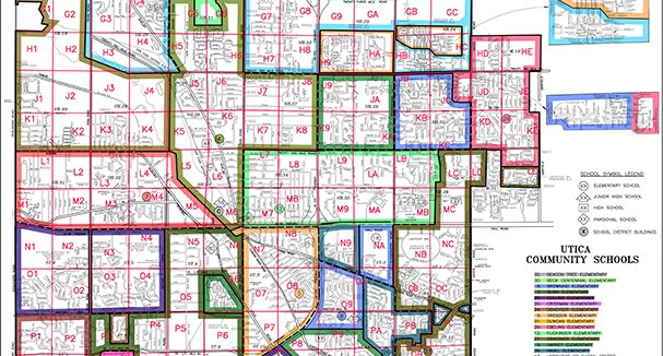
Geographic Information System (GIS) Project: Utica Community Schools
Utica Community Schools (UCS), Michigan’s second-largest school district, needed an accurate base map showing the 67 square mile footprint that the district serves. UCS needed a mapping product with an appealing design that would also allow for efficient and timely updates.
Our GIS team, utilizing shared data sets from local and county government, has digitized historical information, incorporated changes from the district, and created a comprehensive digital map for the District. The resulting Elementary, Jr. High, and High School maps show right-of-ways, public roads and streets, street names, school district boundaries, school service areas, school names and locations, school location numbers, DA lines, community names, and development names. AEW performs mapping updates and distributes a new set of maps every Fall for the school district.

