Simplifying Sidewalk Programs with GIS
Posted on June 10, 2021
It was Easter Sunday of 1984. The Detroit Tigers were on their way to a historic 35-5 start, and my dad surprised me with a Kmart blue light special Huffy bicycle, the Superman version if I remember correctly. Out to the front yard we went, both of us eager to accomplish this rite of passage. My dad didn’t believe in training wheels, and this was long before helmets and knee pads were the norm, so my mom no doubt readied the band-aids and Neosporin as we raced up and down the sidewalk.
On my third solo trip, I was 5 or 6 houses away from my jogging father. I could hear him yelling “Turn, turn, turn!” as I approached the last house on our block. “No problem,” I thought, “I’ll just turn around in this driveway!” As I made the turn from the sidewalk to the driveway approach, my front tire caught on a 3-inch piece of raised concrete and over I went, tumbling to the pavement. I wish I could say that this was the moment I swore to devote my life to safe sidewalks, but I’m certain I was much more concerned in the moment with my skinned knees and elbows.
In an effort to minimize tragedies such as this, many communities administer a yearly program to replace damaged or dangerous sidewalks. Tracking these projects can be cumbersome, with field notes and quantities hand written, addresses logged and locations marked. Once the field data collection is completed, the information must then be hand entered into a spreadsheet, introducing yet another task and opening up the possibility of typographical errors.
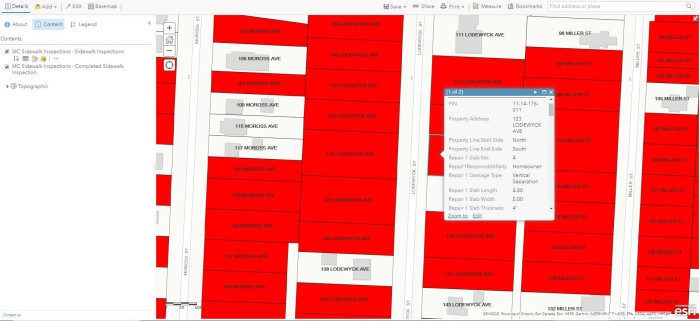
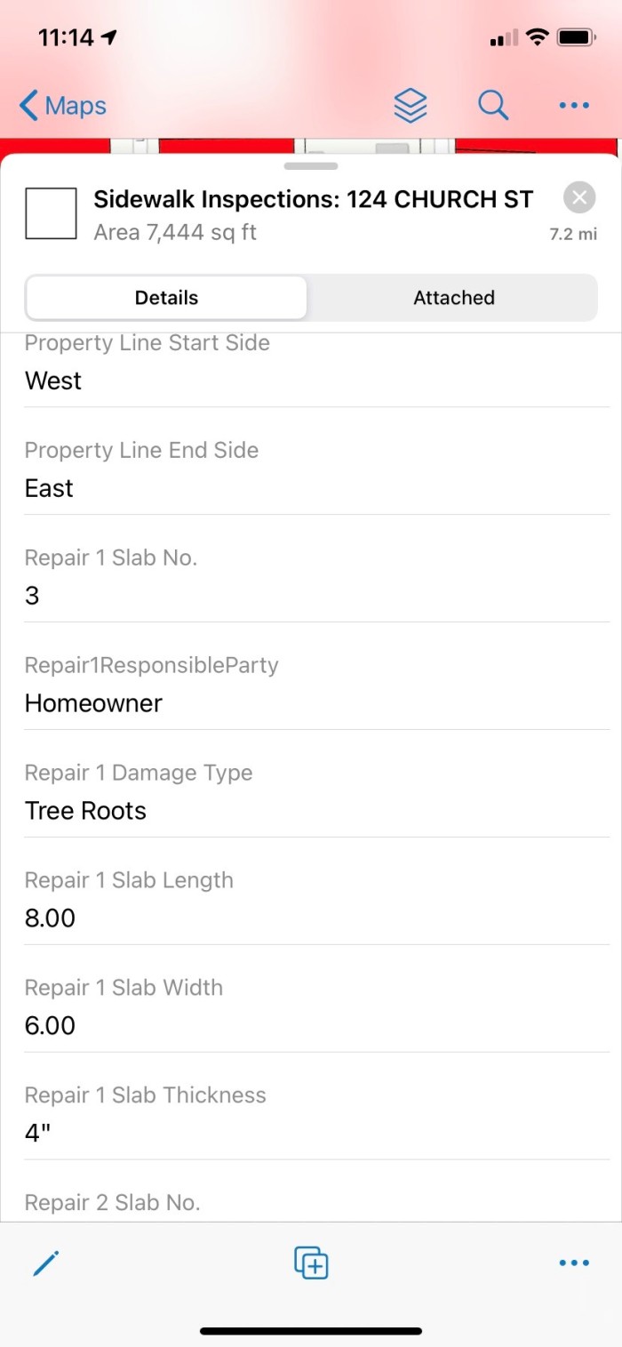
In 2016, AEW went to work creating a GIS application that would streamline the field data collection process. Using the parcel layer as a base, an app was developed allowing field crews the ability to enter repair information on a slab by slab basis, recording information relating to length and width of the slab, sidewalk thickness, reason for replacement, and the party responsible for the repair, be it homeowner or city. All of the field information is tied to the responsible parcel and is immediately available in AEW’s GIS Portal as soon as the record is saved.
Another useful feature of the application is the ability for field crews to collect photographs and video at each property. Frequently, questions from homeowners arise as to why some sidewalk slabs were selected for replacement and why some were not. In most cases, the photos and video collected recorded on site the day of the inspection saves our team from having to revisit the property, allowing the AEW team to virtually walk the property again without ever having to leave the office. This functionality has proven to be a significant time and money saver for our clients.

In addition to improving efficiency during field data collection, AEW has also optimized the homeowner notification process. Employing the use of ArcGIS’s report tool, a preconfigured mailer is created, harvesting the data collected in the field and summarizing it by sidewalk type, area, and total cost. A single page document is created for each property requiring work, the specific verbiage of which is customized for each community, taking the burden of generating these informational mailers out of their hands.
Every one of us drive by these sidewalks on a daily basis and probably never give them a second thought. But living in a walkable and rideable community is more of a draw than many people realize. Whether you’re heading out for a nice evening stroll or teaching your youngster how to ride a bike, doing so on a safe and even path is beneficial for everyone. And please, even if the sidewalk IS nice and even, a helmet and kneepads for those rookie Huffy riders might not be the worst idea…

Jeff Miller started his career at AEW as a GIS Specialist in 2006, becoming the GIS Manager in 2015. His work in the GIS field has taken him from Fenton, MI to Boca Raton, FL to Mesa, AZ, and finally back to AEW (just testing out retirement locations, apparently…). Jeff graduated from Central Michigan University in 2004 with a degree in Geography with GIS and Land Use Planning concentrations. When he isn’t administering AEW’s Enterprise GIS environment, he enjoys playing all sports, camping, listening to GOOD music and learning to play the piano, albeit very slowly…