Demistifying Surveying
Posted on August 5, 2020
My GIS colleague, Jeff Miller, wrote a great article titled “Demystifying GIS.” His article stated that he is in the business of making maps. He does make maps and they are awesome, or as we like to say, “AEWsome.” I completely understand his challenge, though, when trying to explain his profession to someone. Surveying is just as difficult to explain. But I thought I would give it a try by giving some examples.
When I am asked about surveying, I always struggle with the definitive answer, because there is no definitive answer. Even though I have answered this question many, many times, I am struggling with my laptop right now, just hoping that the right words will pop up on the screen. I suppose, the most simplistic answer that I have ever heard is, “Surveyors measure everything above the Earth, on the Earth and below the Earth.” While it is simplistic, it is also accurate. That is what is so cool about this profession. We never know what we will be measuring tomorrow.
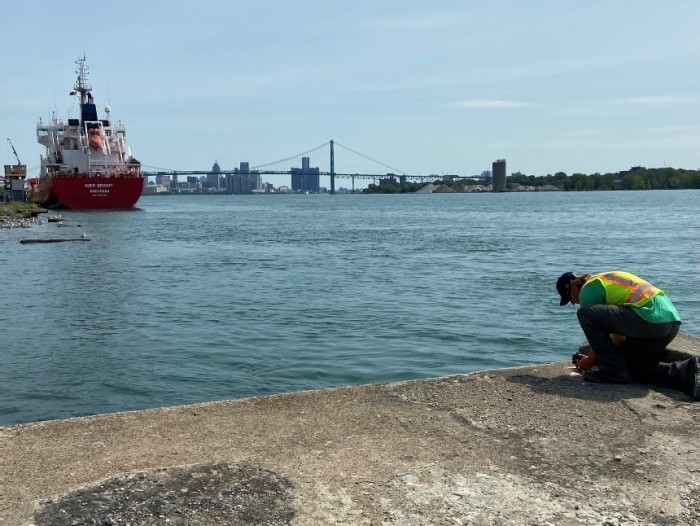
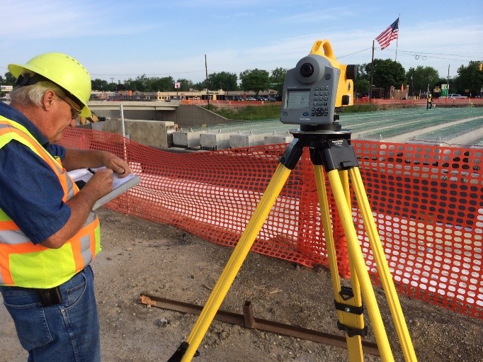
One thing you can count is a variety of work environments. Today you might be measuring above ground on a tall bridge. Tomorrow you might be measuring on the ground to map the location of an endangered butterfly in a large, forested site scheduled for development. Next week you could be seven stories below the Earth’s surface mapping the interior of a pipe. Often, we are measuring in an environment in which we say, “I can’t believe I am getting paid to do this!” Sometimes we are measuring in an environment in which we say, “I should be getting paid a lot more to do this!” Sometimes we are making measurements from drones or helicopters. Sometimes we are making measurements from a boat. Sometimes we are making measurements as we hike through woods and wade through rivers.
Currently we are monitoring concrete slabs and geotechnical devices for movement. Our accuracy criteria is 2 millimeters. It isn’t easy, but with the right equipment, the right methodologies and, most importantly, the right people, it can be done. Very challenging. We are occasionally hired for monitoring projects to detect even the slightest movement of ground or structures.
A year ago, we measured the interior of a six-floor building with a scanner that obtains 2 million data points every second, from which a highly accurate 3D model is made. The building had been built 60-70 years ago, and accurate plans of the building as it exists are not available. Because of our survey, those plans are now available. Very cool!
I received a phone call on Christmas Day a few years ago to use my drone to monitor ground movement in an area the size of a football field that was sinking and had already claimed two houses. It was a horrible situation for the homeowners, who were safe, but it was a cool application of measuring with a drone. We were able to detect movement that was not visible to the eye, but was occurring for almost a week. The drone gave us a way to safely make these observations.
This week, we had a survey crew seventy feet below ground in a five-feet diameter sanitary sewer, measuring and mapping the alignment of the pipe. The pipe was built in the 1960’s and may need reinforcement. Scanning was the only way to accurately provide detailed mapping of the interior of that pipe. Ok, the environment was nasty, but once again we were scanning to create a 3D model of the pipe. Amazing.
Some jobs are a little less critical. I remember one of our crews taking our hi-tech instruments to follow a cow around a field to accurately measure and identify the grid square in which the cow “made a deposit” for some fund raiser.
We did a survey in downtown Flint to re-establish the long-gone boundary lines of an 1836 subdivision plat. It was originally surveyed before the State of Michigan existed. Now we are using drones and hi-tech instruments to unlock the mysteries of the location of buildings, curbs, and even guardrails that would help us “see” the location of those 1836 boundary lines.
We also have been hired to be an expert witness in a case involving two neighbors. Our client was suing the neighbor for building a mansion to close to the common property line. We did all the work to verify that the mansion was, in fact, too close to the property line. As a licensed professional surveyor, we are viewed by the court as an expert in boundary location and measurement. The case, including our testimony, found its way to the Michigan Supreme Court. Our client ultimately prevailed.
If you live in a subdivision or in a city look around you. Everything you see was built in a specific location because a surveyor used his ability to accurately measure to say “Build it here.” Houses, buildings, roads, bridges, hydrants, manholes, walls, and on and on, were built in a particular spot because of a surveyor.
A vehicle testing facility hired us to measure their facility in Michigan and then sent us to Arizona to use our Michigan measurements to build an exact replica of the testing facility. Their objective was to have identical testing facilities so that they could compare results. Our measurements provided that ability.
A few years ago, we were contracted to provide all of the control and design measurements for 37 bridges being built or renovated on a stretch of highway. Our accuracy tolerance was a quarter of an inch. If we were wrong, even once, the error could cost hundreds of thousands of dollars. Fortunately, due to the efforts of the crew chief on this job, every bridge was built correctly.
So far, I have only scratched the surface of, “What does a surveyor do?” The challenge is trying to encompass all of what we do. We never know what sort of measurements we will be making on our next job. What we do know, is that it is likely going to be something new, something challenging, and something interesting. I can’t believe they pay me to do this job!
I have to go now. My phone is ringing. Will this call have me measuring above the Earth, on the Earth, or below the Earth. Let’s see…….

Craig Amey, Survey
My official signature block says, “Craig P. Amey, PS, Senior Project Surveyor”. I looked up “Senior” in my Encyclopedia Britannica and the definition included words like “elderly”, “older” or the ever-comforting phrase, “in their final years”. Normally, this wouldn’t bother me much, but with the renovations of our office, they replaced my chair with an easy-up recliner, my desk with a TV tray, and my computer with a Sudoku book. Now they’ve asked me to contribute to something called a blog. I am supposed to write about our surveying department and put it on that internet thing. I guess I can write a thing or two, because as the insurance company says, “I’ve seen a thing or two”. I guess I better get writing, right after my nap.