Public vs. Private GIS Applications
Posted on February 2, 2021
Knowledge is power, as the saying goes. GIS, as a whole, is one giant knowledge base. Whether it’s sewer and water main information, property ownership data, or even aerial imagery and LIDAR, a plethora of import decisions can be made by analyzing the GIS. However, depending on the decision being made and the sensitivity of the data itself, you may have a need to restrict who has access to what information. Thankfully, GIS provides you with the means to compartmentalize data and determine who has access to what.
The City of Mt. Clemens is a good example of marriage between public and private information. The City has been working for years to build a robust database containing data on a number of different asset types. Some of this information, such as underground utility information, CCTV video files, sewer and water customer data, and asset inspection results are not necessarily something that the general public needs access to. While hosting this data in AEW’s GIS environment allows stakeholders within the City access to this information with a few clicks, it also keeps this data secure, requiring a user name and password to login to the GIS applications. This data may be viewed through a public website, but it is still kept under lock and key, hidden away from public view.
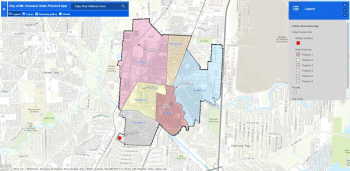
Conversely, there is a good deal of data in the GIS database that the public may find very useful and is not nearly as sensitive. AEW was tasked with creating a handful of public-facing web applications that highlight information relating to Zoning, Land Use, Voting Precincts and Trash Pickup Zones. Even though this data is stored in the same database as the secured data, it is still possible to provide access while keeping sensitive data hidden. By modifying database permissions on a layer by layer basis and adding this information to a completely public web application, AEW created 4 separate applications that highlighted each of the subject matters requested by the City. After providing each individual URL to the City’s IT team, a link was generated on the City’s website which redirected interested parties to the application, still hosted on AEW’s servers. Upon accessing the applications, a user can enter their address into a search bar and be taken directly to their property on the map, were they can easily see the day of the week their trash is picked up or where they need to go to vote. Also, from a community development point of view, it could be easily determined what the zoning or land use is for a given property.
Who you provide data access to and what data you make available is entirely up to you. GIS provides the flexibility to not only store all of your data in one, neat container and disseminate information across an entire enterprise, but to also pick and choose the level of access you feel is appropriate. If you’d like to discuss the possibilities of making areas of your data public, feel free to reach out to me at jmmiller@aewinc.com. We’d love to help!

Jeff Miller started his career at AEW as a GIS Specialist in 2006, becoming the GIS Manager in 2015. His work in the GIS field has taken him from Fenton, MI to Boca Raton, FL to Mesa, AZ, and finally back to AEW (just testing out retirement locations, apparently…). Jeff graduated from Central Michigan University in 2004 with a degree in Geography with GIS and Land Use Planning concentrations. When he isn’t administering AEW’s Enterprise GIS environment, he enjoys playing all sports, camping, listening to GOOD music and learning to play the piano, albeit very slowly…